 Vacation Tours of Ireland
The Wild Atlantic Way: The Route From Inishowen to Kinsale
The Wild Atlantic Way is the signed coastal route that runs the full length of Ireland's west coast. This guide explains what it is, how the route is zoned, how long a full drive takes and which way to go. It then works south from Malin Head in Donegal to Kinsale in Cork, naming one stop per section, with the distances and dates taken from official sources. If you would rather leave the driving to someone else, the guided options on this site cover long stretches of the route, and vacation tours of Ireland compares them side by side. You can also jump straight to the 10-Day Wild Ireland Tour if you already know you want the full sweep with a small group.
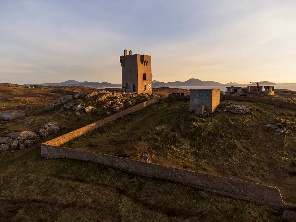
The old signal tower on the headland at Malin Head. Photo: Greg Clarke, CC BY 2.0, via Wikimedia Commons
Quick answer The route in brief
The Wild Atlantic Way is a coastal route of about 2,500 km (1,553 miles) from the Inishowen Peninsula in County Donegal to Kinsale in County Cork, launched in 2014. It passes through nine counties across three provinces. Signs along the way use the WAW logo, so navigation is straightforward once you are on the road.
Key takeaways
- Short on time? The 10-Day Wild Ireland Tour covers Dingle, Killarney, Connemara and the Cliffs of Moher for $3,301 in a group of up to 16.
- Two of the route's best stretches get their own guides: the Dingle Peninsula and Connemara.
- Comparing the bookable multi-day tours side by side lives on the homepage comparison table: tours of Ireland.
The Route at a Glance
The Wild Atlantic Way is signed north to south, from Inishowen down to Kinsale, and the signage went in fast. It launched in 2014 and by June of that year 3,850 signs stood at 950 junctions.
The Three Bands of the Route
Tourism bodies group the route into three named bands, and the stages within them tell you what each stretch delivers. The table below pulls the counties and stages together so you can match a band to the days you have. The route is organised into 14 stages in total, and discovery points along the way carry the WAW logo on their own signs, so a paper map is not strictly necessary.
Photo markers and interpretation panels were added from 2015, starting at Cnoc Fola (Bloody Foreland) in Gweedore, County Donegal.
| Zone | Counties | Highlights |
|---|---|---|
| Northern Headlands and Surf Coast | Donegal, Sligo, north Mayo | Inishowen, Fanad Head, Slieve League Coast, Donegal Bay and Sligo, Erris |
| Bay Coast and Cliff Coast | Mayo, Galway, Clare, north Kerry | Achill and Clew Bay, Killary Harbour, Connemara, Burren and West Clare, Shannon Estuary |
| Southern Peninsulas and Haven Coast | Kerry, Cork | Dingle Peninsula, Ring of Kerry, Beara and Sheep's Head, West Cork |
How Long It Takes and Which Way to Drive
The full route of about 2,500 km needs a generous block of time, and no official recommended number of days is published, so plan by band instead. The route has three bands and the tours below each cover part of it. Drive it north to south: the route is signed from Inishowen down to Kinsale, so following the WAW logo works in that direction with least second-guessing.
Weather matters as much as distance. Met Eireann describes the west as dominated by the Atlantic, with strong winds and frontal rain from December and moderate to heavy rain in autumn. February to June sees less rain because of anticyclones, and from late June the westerly airflow brings more cloud and humidity. The best time to visit Ireland guide covers the seasons in detail, and driving in Ireland covers the rules of the narrow west-coast roads.
If you would rather not drive at all, the multi-day guided tours from Dublin cover stretches of the route by coach or minibus. The full comparison of dates, prices and what each includes is on the Ireland tours, and the 10-Day Wild Ireland Tour is the option built around this route.
Sources: Ireland.com, Met Éireann
North to South, One Stop at a Time
The route divides naturally into sections. Each block below takes one section and picks a single stop worth planning a day around.
Inishowen and Malin Head
The route begins on the Inishowen Peninsula in County Donegal, and its headline stop is Malin Head, the most northerly point of mainland Ireland. A watchtower built in 1805 stands at the head, and the location appeared in Star Wars: The Last Jedi. The head also gave its name to the Malin sea area in the BBC Shipping Forecast, because a weather station has reported from here since 1885.
Donegal sits inside the Northern Headlands and Surf Coast band, and the road onwards runs through Fanad Head and the Slieve League Coast before the band ends in Erris in north Mayo. Dublin to Derry, the gateway to Inishowen, is roughly 236 km and 3 h 11 min of driving without stops, so allow far longer with stops. Derry makes a sensible base just across the border.
The 6-Day All Ireland Tour takes in Donegal and Derry as part of a six-day loop through the north and west from $1,023.66.
Slieve League
Slieve League in County Donegal has sea cliffs of 601 m, the second highest in Ireland, beaten only by Croaghaun on Achill. The drive to the Bunglass viewpoint leaves the village of Teelin on a narrow road. The cliffs sit inside the Slieve League Coast stage of the Northern Headlands band.
Ben Bulben in County Sligo, 526 m high, is another landmark of the same band. The 10-day small-group itinerary that covers Donegal includes Slieve League itself among its entry-listed stops, which matters because the approach road is the kind of road many drivers are glad to hand over.
Achill and Keem Bay
Achill Island in County Mayo is Ireland's largest island at about 148 km2, joined to the mainland by the Michael Davitt Bridge, completed in 1887. Croaghaun on the island carries sea cliffs of 688 m, described as the third highest in Europe, which puts it above Slieve League. The deserted village at Slievemore holds between 80 and 100 ruined stone houses, one of the starkest records of the island's past.
At the western tip, Keem Bay (Cuan na Cuime) is a Blue Flag beach in a horseshoe of ground that once held a basking shark fishery, and it served as a filming location for The Banshees of Inisherin. Achill sits in the Achill and Clew Bay stage, the doorway into the Bay Coast band. Galway to Westport, the practical base for Mayo, is about 80 km and 1 h 19 min of driving without stops.
Connemara
Connemara is the part of County Galway west of Lough Corrib and Galway city, holding the Twelve Bens mountains, Connemara National Park and the main town of Clifden. It is the largest Gaeltacht in Ireland, with roughly 20,000 to 24,000 native Irish speakers. Kylemore Abbey was built from 1867 as a private home for Mitchell Henry, and Irish Benedictine nuns bought it in 1920.
Its Victorian walled garden was laid out in 1870. The stage within the route is Killary Harbour and Connemara, and Galway city itself, home to 85,910 people at the 2022 census, makes the natural gateway with its Spanish Arch and cathedral. We keep a full guide to Connemara on this site.
Guided coverage includes the 5-Day Northern Ireland and Atlantic Coast Small-Group Tour, which runs from the Causeway coast and Derry down through Donegal, Mayo and Connemara to Galway from $1,486.20, and the 10 Day Wild Irish Experience Small Group Tour, which books a two-night stay in Connemara with Kylemore Abbey entry included.
The Cliffs of Moher, the Burren and Loop Head
County Clare carries two of the route's biggest names. The Cliffs of Moher run about 14 km and reach 214 m north of O'Brien's Tower, built in 1835 by Sir Cornelius O'Brien. Around 30,000 pairs of birds nest on the cliffs, and the area has been part of the Burren and Cliffs of Moher UNESCO Geopark since 2011.
Inland, the Burren covers about 530 km2 of karst limestone roughly 325 million years old, where over 70 percent of Ireland's flower species grow, including 23 of the country's 28 orchid types. Poulnabrone dolmen carries a 3.9 m capstone. Doolin, about 4 miles from the cliffs, is a ferry hub for the Aran Islands and a base for nightly traditional music.
South of the cliffs, Loop Head Lighthouse stands 23 m tall, built in 1854 and automated since 1991, on a peninsula with the Atlantic on one side and the Shannon Estuary on the other. Day tours reach the cliffs from Dublin, and the Cliffs of Moher, Burren & Galway City Day Tour gives 2 hours at the cliffs with visitor centre entry for $87.
Dingle
The Dingle Peninsula is the first stage of the Southern Peninsulas and Haven Coast band. Dingle town, about 50 km southwest of Tralee and 71 km northwest of Killarney, had 1,671 residents at the 2022 census and sits in a Gaeltacht. The peninsula ends beyond the town at Dunmore Head, the westernmost point of mainland Ireland.
Mount Brandon rises 951 m, the second-highest peak outside MacGillycuddy's Reeks. The Slea Head Drive loops past Ventry Beach, beehive huts and Gallarus Oratory, and at Slea Head itself you get a full view of the Blasket Islands, uninhabited since the 1950s and known for the writing of their former inhabitants. Getting there takes planning: the peninsula tourism association puts Dingle at 352 km and 4 hours 15 minutes from Dublin Airport, and warns the peninsula roads are narrow and hilly.
The dedicated Dingle Peninsula guide covers it properly.
The Ring of Kerry and Skellig
The Ring of Kerry is a 179 km (111 mile) circular route through Killarney, Kenmare, Sneem, Waterville, Cahersiveen and Glenbeigh. Tour buses run counter-clockwise so they can pass each other on the narrow roads, and many private drivers go clockwise to Kenmare first to avoid meeting the coaches, so pick your direction with that in mind. Killarney National Park, Ireland's first national park and a UNESCO biosphere reserve since 1981, holds about 900 red deer of the native Irish subspecies, the only remaining wild native herd in the country.
Off the Iveragh Peninsula, Skellig Michael lies 11.6 km out to sea, was listed by UNESCO in 1996, and carries about 600 stone steps up to the monastery. Landings are capped at 180 visitors a day and run in season, weather permitting. Valentia Island has a bridge to Portmagee and a seasonal car ferry from April to October, and the first commercially viable transatlantic telegraph cable landed there in 1866.
From Killarney, the Ring of Kerry Guided Day Tour runs 7.5 hours including the Skellig Ring for $55.
Mizen Head and Kinsale
The route finishes in Cork. Mizen Head, traditionally the most southerly point of mainland Ireland, stands about 101.6 m high and carries a bridge over a chasm to a former signal station that is now a museum. From there the Haven Coast stage runs east through West Cork to Kinsale, about 25 km south of Cork city, home to 5,991 people at the 2022 census and the official southern end of the Wild Atlantic Way.
Kinsale is known for food festivals, and Charles Fort, a star fort completed in 1677, guards the harbour. The town's place in Irish history runs deep, because the Battle of Kinsale in 1601 saw English forces under Mountjoy defeat an Irish force backed by Spain. Cork city itself rewards a stop, and the English Market there traces its origins to 1610, with the current building dating to 1786.
If you are building a longer trip around the route, the Ireland itinerary guide shows how the pieces fit together.
The Tours That Drive It
Several guided tours from Dublin cover long stretches of the route without you having to drive the narrow coastal roads yourself.
Which Tours Cover the Route
Every tour below starts in Dublin and includes accommodation with breakfast. None of them lists lunch as included or offers hotel pickup, so plan to buy food along the way. The prices come from each tour's own listing card.
The full side-by-side comparison of all the multi-day options sits on the homepage of vacation tours of Ireland in its comparison table.
| Tour | Part of the route | Days | Price |
|---|---|---|---|
| 10 Day Wild Irish Experience | Wicklow, Tipperary, Cork, Kerry, Clare, Galway and Mayo, the southern two bands plus the Ancient East | 10 days, 9 nights | $3,301 |
| 10-Day Ultimate Small-Group Tour | Donegal, Sligo, Galway, Clare, Kerry and Cork, almost the whole route, run from south to north | 10 days, 9 nights | $3,917.02 |
| 6-Day All Ireland Tour | Northern Ireland, Donegal, Sligo, Galway, Clare, Kerry and Cork, with nights in Dingle and Killarney | 6 days, 5 nights | $1,023.66 |
| 7-Day Ireland to Island Tour | Cork, Kerry, Clare and Galway, the Cliff Coast and Southern Peninsulas | 7 days, 6 nights | $2,823.90 |
| 5-Day South West Tour | Galway, Clare, Kerry and Cork, the middle and southern bands | 5 days, 4 nights | $1,464.67 |
| 5-Day Northern Ireland and Atlantic Coast Tour | Antrim, Derry, Donegal, Mayo and Galway, the northern half | 5 days, 4 nights | $1,486.20 |
| 4-Day South West Ireland Tour | Galway, Clare, Kerry and Cork in a coach group of up to 56 | 4 days, 3 nights | $568.20 |
How to Choose
If you want the longest single run along the route, the 10-Day Ultimate Small-Group Tour is the pick. It starts with the Rock of Cashel, Blarney Castle and Kinsale in the south, works up the west coast and finishes in Donegal, Derry and Belfast, with entry to the Cliffs of Moher, Slieve League, Kylemore Abbey and more than a dozen sites included in the $3,917.02 price, though it books as non-refundable and takes children only from age 12.
If you want a full southern and western loop with free cancellation, the 10 Day Wild Irish Experience at $3,301 holds a 5.0 rating from 119 reviews and covers Glendalough, the Rock of Cashel, Kylemore Abbey, the Cliffs of Moher and the Shannon ferry, all with fees included. It is capped at 16 passengers.
For the northern band only, the 5-Day Northern Ireland and Atlantic Coast Tour links the Causeway coast, Derry, Donegal, Mayo and Galway for $1,486.20, with free cancellation up to 21 days. Note that its admission fees are not included.
On a tighter budget, the 4-Day South West Ireland Tour starts from $568.20 in a shared hostel dorm and hits Galway, the Cliffs of Moher, Killarney and the Dingle Peninsula. Breakfast is included, admissions are not listed as included, and the booking is non-refundable.
Day tours can cover small pieces too. From Galway, the Aran Islands and Cliffs of Moher tour at $89 adds the Cliff Coast with ferry and cliff admission in the price. From Killarney, the Ring of Kerry day tour at $55 loops the 179 km circuit in 7.5 hours.
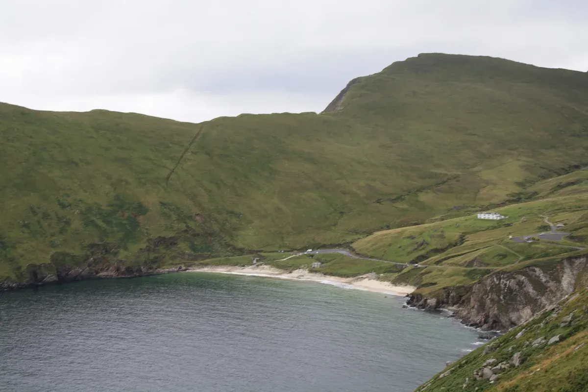
Keem Bay's small beach below the cliffs of Achill Island. Photo: Geyo John, CC BY-SA 3.0, via Wikimedia Commons
Weather and Practical Notes
The route faces the open Atlantic, and that shapes both the weather and the driving.
Rain and Daylight
Met Eireann describes Ireland's west as dominated by the Atlantic, with strong winds and frontal rain from December and moderate to heavy rain in autumn. February to June sees less precipitation, and spring warms slowly because the sea stays cold. From late June the westerly airflow brings more cloud, humidity and rainfall. Weather patterns do not recur regularly each year, so no month guarantees a dry run.
Pack layers and a waterproof shell at any time of year. For month-by-month detail, see the guide to the best time to visit Ireland.
- Frontal rain from December and heavier rain in autumn, per Met Eireann
- Drier window from February to June
- More cloud and rain from late June onward
Narrow Roads and the Coach Direction Rule
The peninsula roads on the route are narrow and hilly, as the Dingle Peninsula tourism association warns, and the last part of any drive onto a peninsula is slow. Slieve League's Bunglass viewpoint sits at the end of a narrow road from Teelin. If you plan to drive yourself, read the guide to driving in Ireland first.
Coaches have one firm rule on the Ring of Kerry. Tour buses run counter-clockwise so they can pass on the narrow roads, and many private drivers go clockwise via Kenmare first to avoid meeting the coaches. Follow the same logic on any peninsula loop. The official signs carry the WAW logo, and Discovery Points are marked with the same logo, so a paper map is not strictly necessary. For a fuller route plan, see the 7 day Ireland itinerary.
Frequently Asked Questions
How many days do you need for the Wild Atlantic Way?
There is no official figure for a full drive. Multi-day guided tours cover major stretches in 4 to 10 days, with the 10-day options running the largest share of the route. For a self-planned trip, our 7 day Ireland itinerary shows how much of the west coast fits in a week.
Where does the Wild Atlantic Way start and end?
The signed route runs from the Inishowen Peninsula in County Donegal to Kinsale in County Cork, and the signage points north to south. Malin Head on Inishowen is the most northerly point of mainland Ireland, and Kinsale holds Charles Fort, a star fort completed in 1677.
Can you drive the Wild Atlantic Way without a car?
Yes. Guided multi-day tours from Dublin cover it by coach and minibus, such as the 10 Day Wild Irish Experience, which uses two-night stays in Connemara, Dingle and Killarney. Rail serves part of the west too, with Dublin to Killarney trains taking about 3 hours 21 minutes with a change at Mallow.
What is the best part of the Wild Atlantic Way?
It depends on what you want. Donegal has Slieve League, sea cliffs of 601 m. Achill Island has the 688 m Croaghaun cliffs and Keem Bay. Clare has the 14 km Cliffs of Moher, and Kerry has the 179 km Ring of Kerry and Slea Head. Our Dingle Peninsula and Connemara guides cover two of the strongest stretches in detail.
What are the three sections of the route?
The official site groups it into three bands. The Northern Headlands and Surf Coast covers Donegal, Sligo and north Mayo. The Bay Coast and Cliff Coast covers Mayo, Galway, Clare and north Kerry. The Southern Peninsulas and Haven Coast covers Kerry and Cork, including the Dingle Peninsula and West Cork.
How much does a guided tour of the Wild Atlantic Way cost?
Multi-day guided tours that include the route start from $568.20 for 4 days in a hostel dorm and reach $3,917.02 for 10 days in small-group boutique accommodation. What the price covers varies a lot between them, so compare what is included before booking.